Surveying in Pacific Palisades
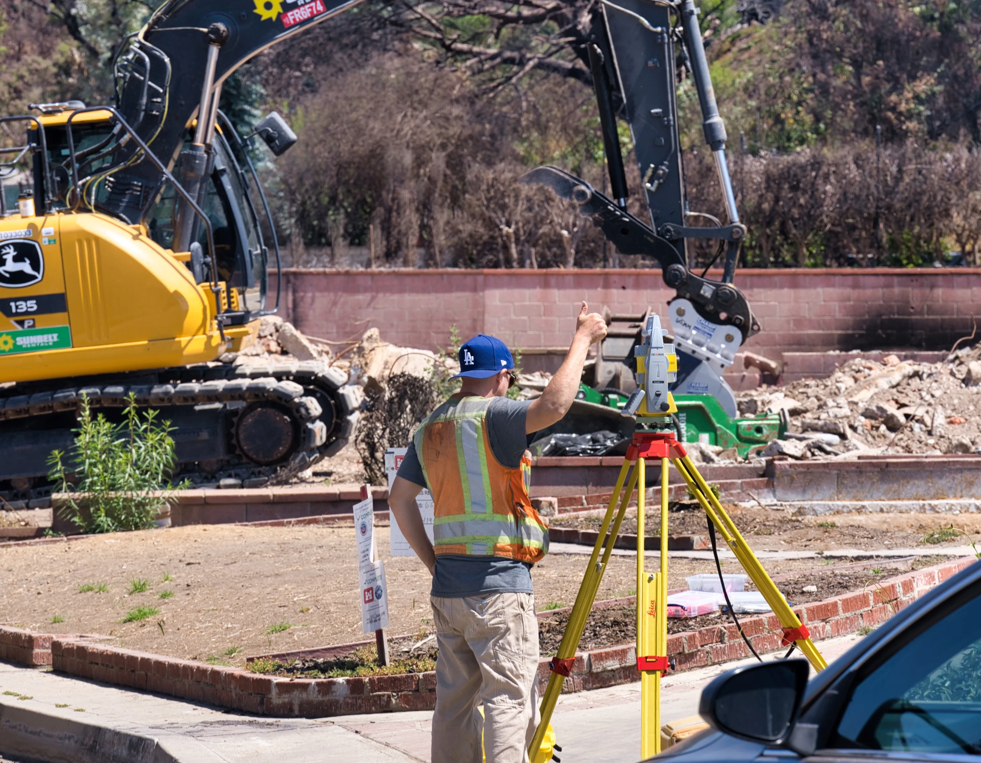
Pacific Palisades is part of the City of Los Angeles, so LADBS issues the building and grading permits and the Department of City Planning holds zoning and entitlements. From a surveyor's side, three things set the Palisades apart from the rest of the city. Most Palisades properties lie within the City's Hillside Area, and that changes two measurements. Building height is measured point by point, as the difference between each point on the roof and the topography surveyed around the building, rather than from the single lowest ground point within five feet of the building envelope that applies on a flat lot. And floor area on a hillside lot is set from a slope analysis, so the topographic survey has to support one. More lots than almost anywhere else in the city sit on a bluff or canyon edge that has to be surveyed. And across the burn area the property corner monuments are frequently gone, so the boundary has to be re-established before anything else can be measured against it.
We work the Palisades for property owners rebuilding, and for the architects, civil engineers and contractors carrying those projects through plan check. Every survey is performed under a licensed California land surveyor, PLS 8099, and prepared to the content LADBS and City Planning reviewers expect.
Fire Rebuild Survey Support in Pacific Palisades
Lot width, lot depth, where the footprint sits and how tall the house may be all come back to the boundary and the grade, which is why the boundary and topographic surveys come first on a Palisades rebuild and everything else is drawn on top of them. Drawing the pre-fire and proposed footprints is the architect's work; ours is the base they are drawn on.
What we typically deliver on a Palisades rebuild
- Property line survey with monuments found, referenced or set, and a Corner Record filed with the LA County Surveyor where the boundary work calls for one
- Topographic survey, stamped
- Boundary and topographic base map the architect draws the pre-fire and proposed footprints on
- Slope analysis map for the floor area calculation on new construction, meaning any project that is not a like-for-like rebuild
- Building height survey on a topographic base, with several points along the ridge or parapet and the eaves
- Construction staking of the proposed building and structures
- Setback verification survey at the foundation form stage, before concrete is placed
- Building pad as-built survey, or an as-graded survey where the grading permit calls for one
Aerial coverage over parts of the Palisades
We have collected UAV aerial imagery and survey data over portions of Pacific Palisades. On cleared adjacent lots this is where aerial work earns its keep, because bare-earth topography across several parcels in one flight beats ground survey economics badly. Coverage is not comprehensive and we will not assume your lot is included. Send us the address and we will confirm what we already hold before scoping the survey. Airspace is verified per parcel before any flight.
One caveat we would rather state than have you discover: the Palisades ground surface has moved. Ash, sheet erosion, hydroseed and interim grading changed it, and the storm seasons since the fire reworked slopes. We date-stamp every flight and say on the deliverable what the surface represents.
Common Projects We Support in Pacific Palisades
Beyond rebuild work, we support a wide range of Palisades residential and commercial survey needs.
- Boundary and property line questions - fences, walls, neighbor disputes
- Topographic and design base maps for architects and civil engineers
- ADUs, additions, and new home construction
- Hillside lot analysis, slope mapping, and grading feasibility
- Fire rebuild documentation and design support
- Coastal bluff properties and view-sensitive design projects
- As-built surveys for permit closeout and records
- Construction staking for foundations, building corners, and site work
Why Local Experience Matters in the Palisades
Hillside and bluff expertise
Palisades lots often involve steep grades, view restrictions, and complex site conditions. We work with hillside lots regularly and deliver surveys designed for hillside ordinance compliance and grading feasibility.
Fast response for rebuild projects
Our field-to-finish automation workflow accelerates map production, and UAV coverage in parts of the area can further shorten turnaround. Rebuild teams need speed without sacrificing accuracy, and that is what we deliver.
Licensed PLS oversight
Sergei Builoff, California PLS 8099, personally oversees every survey. No outsourcing and no project management layer between you and the responsible surveyor.
Local crews, Los Angeles knowledge
Based in Calabasas and incorporated in California in 2006. Familiar with LA permitting, County recording, hillside ordinance, and the specific parcel conditions common in Palisades neighborhoods.
Services Available in Pacific Palisades
Full survey and mapping service range available for Palisades projects. Click any service for full details.


Pacific Palisades Survey FAQs
Do I need a land survey to rebuild my home in Pacific Palisades?
How is building height measured in Pacific Palisades?
What is an as-graded survey, and who signs it?
My architect is self-certifying the plans. Do I still need a surveyor?
How quickly do you need to be on site once the project is moving?
I was told a corner record survey is required. Is that true in the Palisades?
Do I need a boundary survey for a like-for-like rebuild?
What is a bluff setback, and who decides where the bluff edge is?
The city suspended permit fees. Does that cover the survey?
What do you need from me to get started?
Request a Pacific Palisades Survey Quote
Areas Served
Neighborhoods We Cover
We work throughout Pacific Palisades, including Huntington Palisades, the Alphabet Streets, North Village, the Commercial Village and Palisades Village, the Riviera, Rustic Canyon and the Will Rogers area, Potrero Canyon, Temescal Canyon, Via Bluffs, El Medio Bluffs and Las Casas, Castellammare and Paseo Miramar, Upper and Lower Marquez, the Palisades Highlands, Sunset Mesa, Tahitian Terrace, Palisades Bowl and Malibu Village.
In the Palisades Highlands, recorded maps draw lines that limit where a house may be placed on certain lots. Those lines are plotted from the recorded map onto the boundary survey and located on the ground, not scaled from a screen.
Local Records and Permitting
The departments and records sources behind Palisades survey work:
- LADBS - building and grading permits, plan check and inspections. The Wildfire Rebuilding and Recovery page links every rebuild bulletin and portal.
- Department of City Planning - zoning and entitlements. Rebuild guidance is at Palisades Rebuild and Recovery.
- Bureau of Engineering - right of way, street centerline monuments, benchmarks, and the setback map that fixes distances from street centerline.
- LA County Surveyor, Records of Survey and benchmarks - Records of Survey, Corner Records, field books, tract and parcel maps.
- LA County Registrar-Recorder - deeds, easements, covenants and recorded maps.
- LA County Assessor - parcel maps and recorded lot size.
- ZIMAS - zoning and overlays for a parcel.
Just outside the Palisades, we also serve Malibu, Santa Monica, Topanga and the wider City of Los Angeles.
Memberships and Affiliations
- Corporate Member, California Land Surveyors Association (CLSA)
- Better Business Bureau Accredited Business
- Member, American Association for Geodetic Surveying (AAGS)
- Member, American Society of Civil Engineers (ASCE)

What Clients Say
4.8
★★★★★
★★★★★
Very good surveying company, ordered property line survey from them, very responsive staff, great price good turn around time
Rustam Kereibaev
★★★★★
Very professioanl and responsive company, they did survey for my ADU project in a very short time and for a great price. Definitly recommend
Alex Kimm
★★★★★
Juan surveyed our family property, which was built in the 1920s and involved navigating some difficult terrain. We had a great experience working with him. He was super friendly, helpful, professional, and hardworking from start to finish. He took his time surveying the property, was very thorough and detail-oriented, and was always happy to answer my questions and explain what he was doing along the way. You could tell he genuinely cared about doing a good job and making sure everything was done correctly. I would definitely recommend Juan and Builoff Surveying and Mapping to anyone looking for a surveyor.
Jessica Daly
★★★★★
I recommend this company to anyone who is looking to get boundary and topographic survey for properties affected by palisades fire. They gave me very good price and were very helpful and professional
Muslima Tasbolat
Pacific Palisades
Our Office and Service Area
Builoff Surveying & Mapping, Inc.
4004 Schuylkill Dr
Calabasas, CA 91302
By appointment only
(323) 240-2303Monday to Friday, 9:00 am to 5:00 pm
Serving Los Angeles and Ventura counties
Sergei Builoff, MSc, PLS 8099
The requirements above were compiled from publicly available city and county sources and reviewed on the date shown below. They are general information, not a professional opinion, and they change. Confirm anything you intend to rely on with the administering department before acting on it.